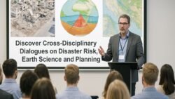
Critical Insights – The DEU-ISGR-23 summit provided a pivotal platform for experts, researchers, and policymakers to share insights on disaster preparedness and scientific risk mapping. By bringing together interdisciplinary teams, the event emphasized evidence-based approaches to disaster management, highlighting the integration of advanced geospatial technologies, predictive modeling, and community-centric strategies. Participants explored how scientific risk mapping can enhance early warning systems, improve resource allocation, and mitigate the impact of natural and man-made disasters. According to UNDRR, integrating scientific data into disaster preparedness planning significantly reduces vulnerability and improves response efficiency. The summit underscored the importance of collaboration between governmental agencies, NGOs, and research institutions, ensuring that risk assessments are both accurate and actionable. DEU-ISGR-23 also highlighted innovative case studies demonstrating how data-driven approaches and technology can be harnessed to predict hazards, manage emergency response, and strengthen resilience at local, regional, and national levels, offering a comprehensive understanding of disaster management in today’s complex environment.


Advancing Disaster Preparedness Through Scientific Research
A core focus of DEU-ISGR-23 was the advancement of disaster preparedness via rigorous scientific research and data analysis. Researchers presented methodologies for assessing hazard vulnerabilities, evaluating risk exposure, and designing mitigation strategies. According to National Academies of Sciences, scientific research provides actionable insights that can transform disaster preparedness from reactive responses to proactive risk management. Sessions emphasized the use of geospatial analytics, satellite imagery, and modeling techniques to identify high-risk areas and prioritize interventions. By integrating these scientific approaches into national and local disaster management plans, communities can anticipate threats, optimize resource distribution, and reduce the impact of disasters on vulnerable populations. DEU-ISGR-23 encouraged collaboration among academic institutions, emergency services, and policy-makers to ensure research findings translate into practical applications that enhance public safety and resilience.

Innovations in Risk Mapping and Hazard Assessment
DEU-ISGR-23 highlighted cutting-edge innovations in risk mapping and hazard assessment, demonstrating how technology and data analytics can revolutionize disaster management. Participants explored the use of Geographic Information Systems (GIS), remote sensing, and machine learning algorithms to map vulnerabilities and forecast potential disasters. According to ScienceDirect, modern risk mapping techniques enable precise identification of at-risk communities and infrastructure, improving both mitigation and emergency response strategies. The summit also showcased interactive mapping platforms that allow decision-makers to visualize real-time risks, simulate disaster scenarios, and develop contingency plans. These tools empower governments and organizations to make informed decisions, reduce response times, and allocate resources efficiently. By emphasizing innovation and practical application, DEU-ISGR-23 reinforced the value of technological solutions in building resilient societies capable of withstanding natural and anthropogenic hazards.
Case Studies Demonstrating Effective Risk Management
A significant component of DEU-ISGR-23 was the presentation of real-world case studies illustrating successful risk management practices. These studies highlighted how predictive analytics, community engagement, and early warning systems have minimized the impact of floods, earthquakes, and other disasters. According to PreventionWeb, examining practical case studies allows policymakers to understand which strategies are effective and how they can be replicated in different contexts. Participants discussed lessons learned from past disasters, emphasizing the importance of local knowledge, interagency coordination, and continuous monitoring of risk factors. By sharing these insights, DEU-ISGR-23 provided attendees with actionable frameworks that can be adapted to enhance disaster preparedness and response in their own regions, reinforcing the critical connection between research and real-world application.

Building Collaborative Networks for Resilient Communities
The summit underscored the importance of building collaborative networks that connect researchers, policymakers, emergency responders, and community leaders. Effective disaster management requires seamless communication and coordination across multiple sectors, ensuring that resources, expertise, and information are shared efficiently. According to IFRC, collaborative networks enhance resilience by fostering knowledge exchange, joint planning, and rapid mobilization during emergencies. DEU-ISGR-23 encouraged participants to establish partnerships that bridge scientific research with practical disaster response, promoting community-centric approaches that integrate both local insights and global best practices. By strengthening these networks, the summit demonstrated how a unified approach to disaster preparedness and risk mapping can save lives, reduce economic losses, and build long-term resilience against evolving threats.